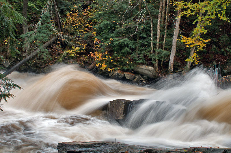
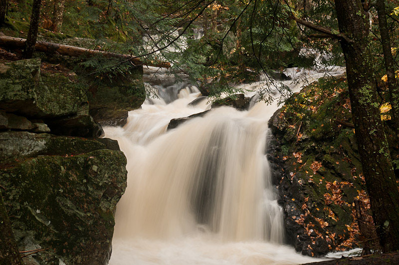
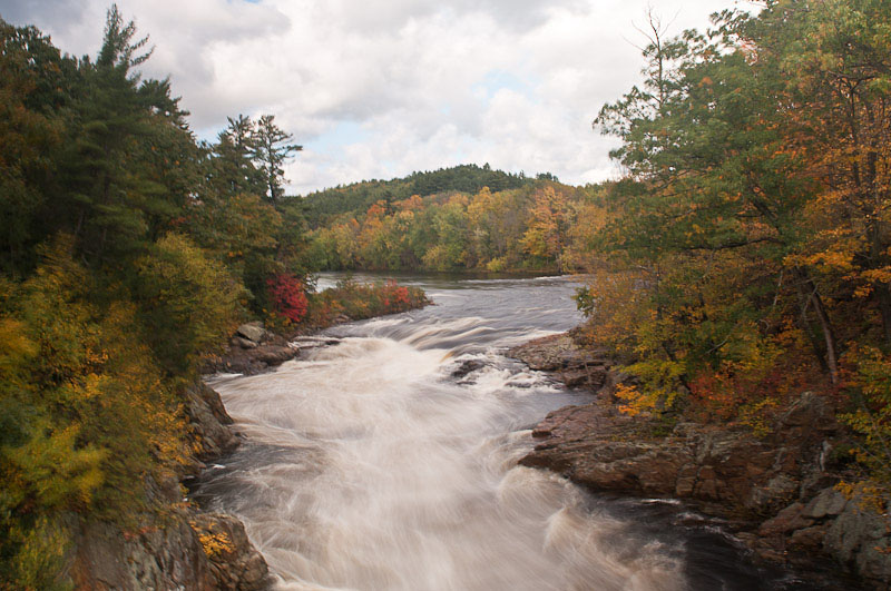
The Bottom of Austin Falls
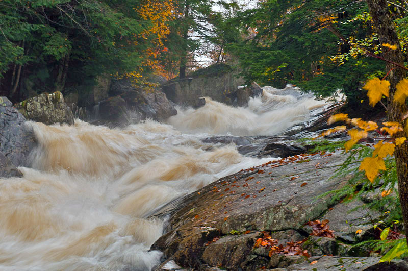
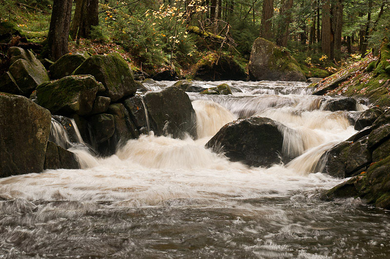
The Top of Austin Falls
A Wet Trip to the Adirondacks, October 6th & 7th, 2010, Day 2
Back to the Home Page
All photographs Copyright © 2010 Jon R. Vermilye
To see a larger image, click on the photo
Other Pages:
Animals & Insects
Birds
Flowers
Flowers, Page 2
Landscapes / Scenic
Lighthouses
New England & Nantucket
Oswego
Other
Images
State & National Parks
Theatrical Images
Waterfalls
Adirondacks Trip Fall, 2004
Adirondacks Trip, Fall, 2007
Well, after a night of off & on rain, a good roast beef sub (it seems all the restaurants are closed for the season) I found a local diner serving breakfast.
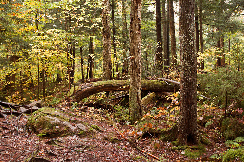
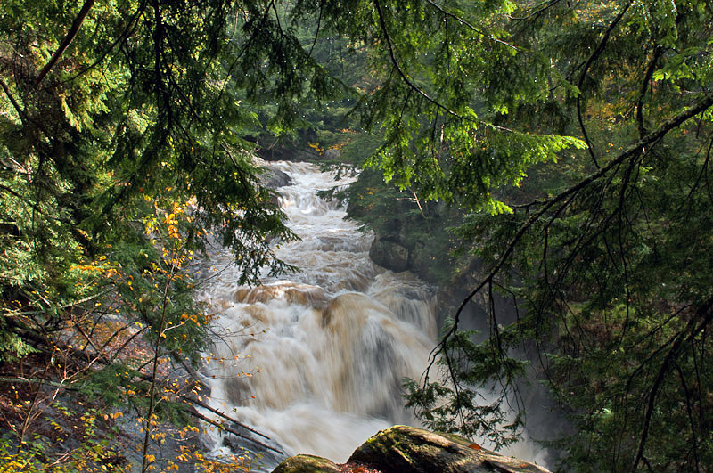
Old Route 8 is an interesting road. It, like many in the park, is labeled as seasonal, that is they don't keep it up during the winter. It is basically a one lane road with many 6" - 8" frost heaves that forces slow driving. I'm glad the GPS location for Austin Falls is accurate since you can't see it from the road. I stopped when the GPS told me to, climbed down the bank, and found a raging river. It is difficult to get close enough to the river to shoot good photos - the bank is slippery rock & falling is is not an option!
|
|
The Bottom of Austin Falls |
The Top of Austin Falls |
I have to admit I spent more time watching the water than shooting it - an amazing powerhouse.
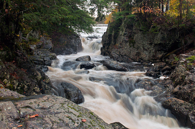
After that it was back down 3 miles of Old Route 8 at 5-10 miles an hour & back onto "New" Route 30 - a big improvement. Although there is an access road on Old Route 8 that goes close to Christine Falls, it is posted because it goes to a power generation dam. New Route 8 / 30 runs on the other side of the Sacandaga River and although hard to find, there is a small parking area just off the road and above the falls. With the extra water going over the main falls, I actually like the small stream next to it better:
 |
 |
 |
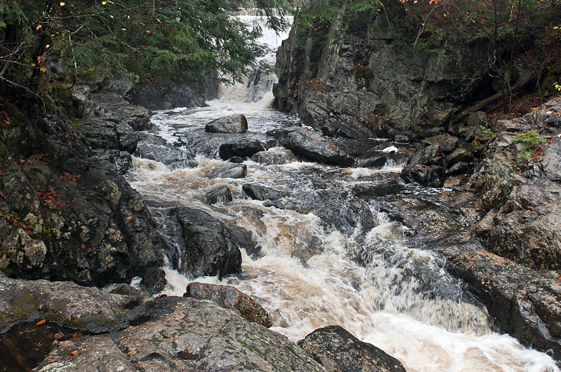
Christine Falls |
Small Stream Next to Christine Falls |
Christine Falls |
Auger Falls is a little further down the river. There is a well marked trail to the falls from the parking lot off Route 8 / 30. The sun actually came out while I was walking to the falls - I added some photos along the trail:
 |
 |
 |
Trail to Auger Falls |
Auger Falls |
Trail to Auger Falls |
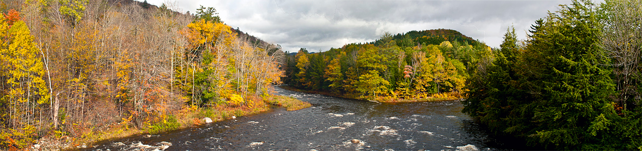
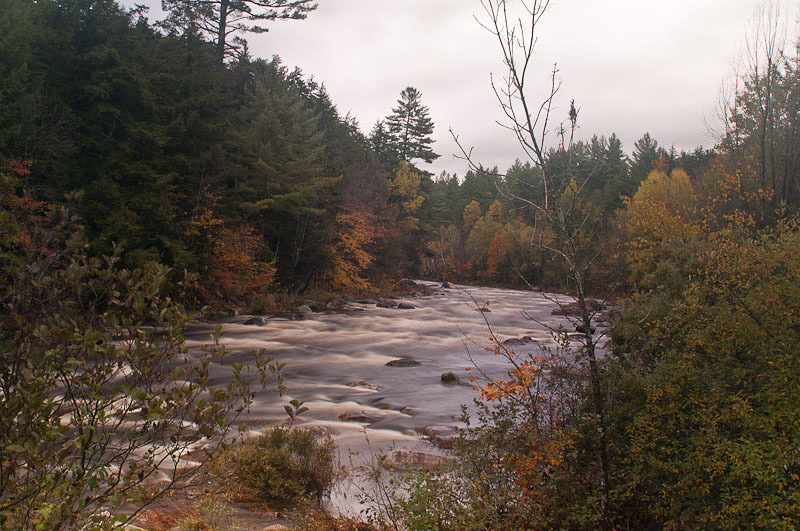
Not too far after Auger Falls, Route 8 splits from Route 30 & crosses a bridge over the Sacandaga River. Here is a panorama looking north from the bridge:
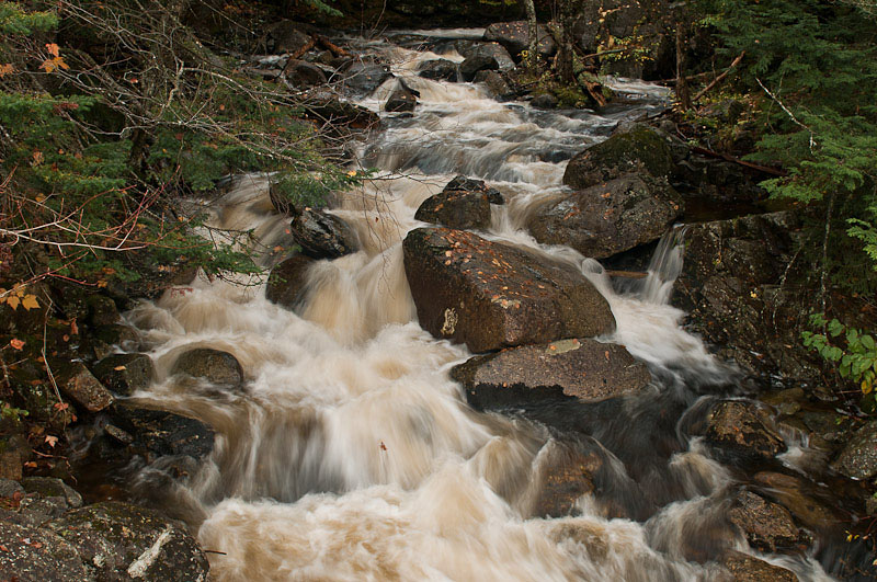
The first stop along Route 8 was to shoot the Jimmy Creek Falls. The stream goes under Route 8 & although it isn't the falls, the cascade going to the bridge under the road is worth a photo. The falls are a little ways up stream.
 |
 |
 |
Cascades Below Jimmy Creek Falls |
Jimmy Creek Falls |
Cascade Above Jimmy Creek Falls |
I also took a photograph of the East Branch of the Sacandaga River where Jimmy Creek enters. It was one of the few locations there there were no trees blocking the river.
I didn't realize there was a bridge crossing the river on Teachout Road a mile or so up river:
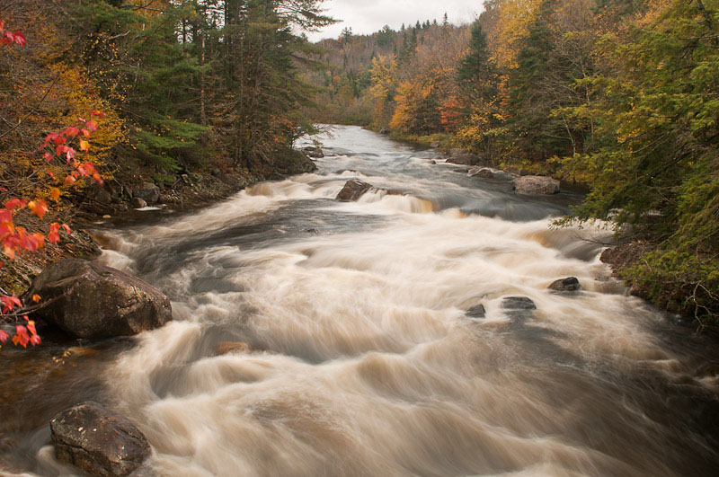
For a final stop I took a photo of the Hudson River at Lake Luzerne. The Hudson is squeezed into a narrow channel and tumbles over Rockwell Falls:
I made a quick trip back to Oswego, arriving home around 4:00. Although not the best couple of days for photographs, I enjoyed the trip & hope to shoot the north end of the park next year.
This page is maintained by: vermilye@oswego.edu
Last Update:
March 21, 2012