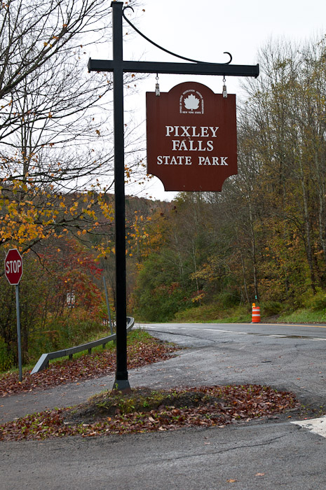
The Park Entrance
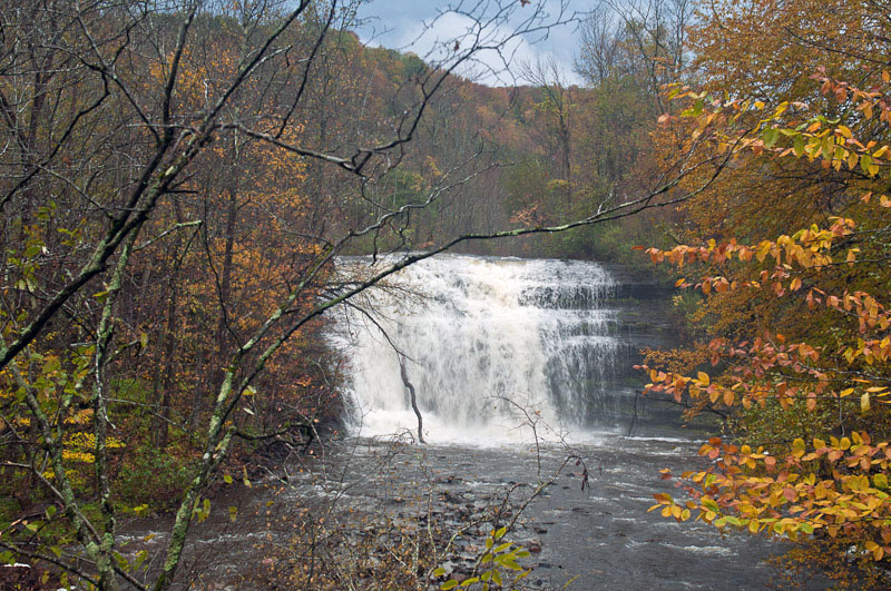
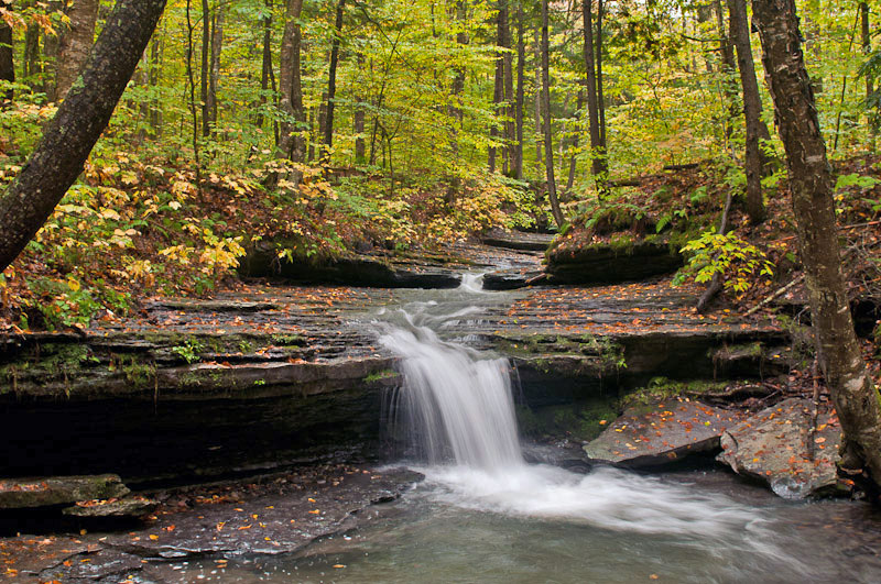
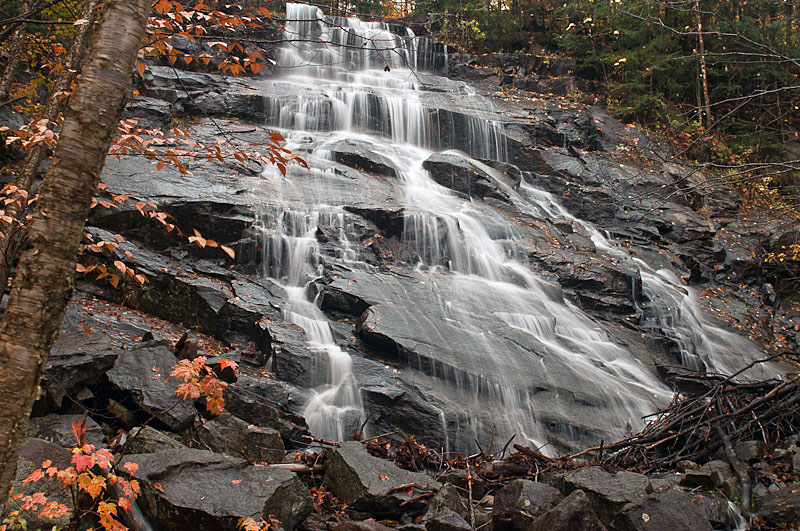
Pixley Falls
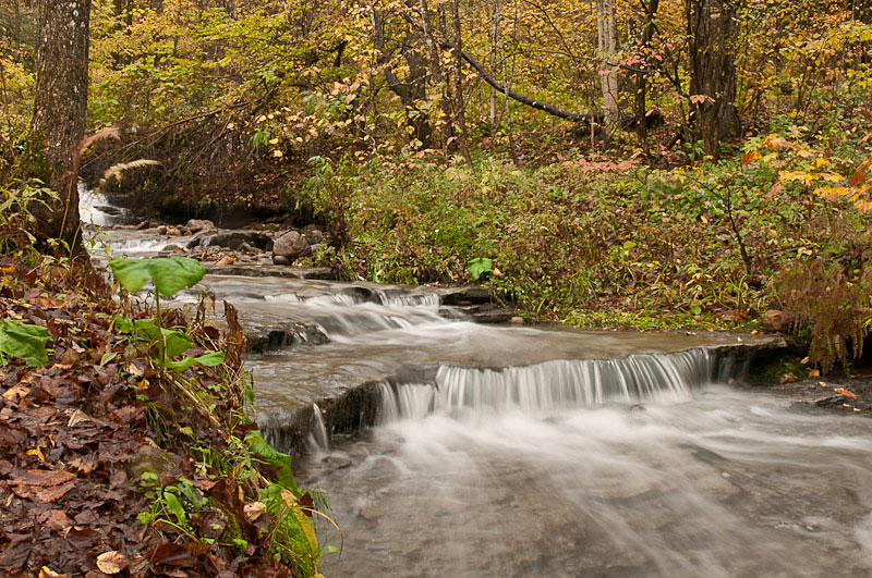
Another Brook in the Park
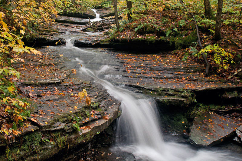
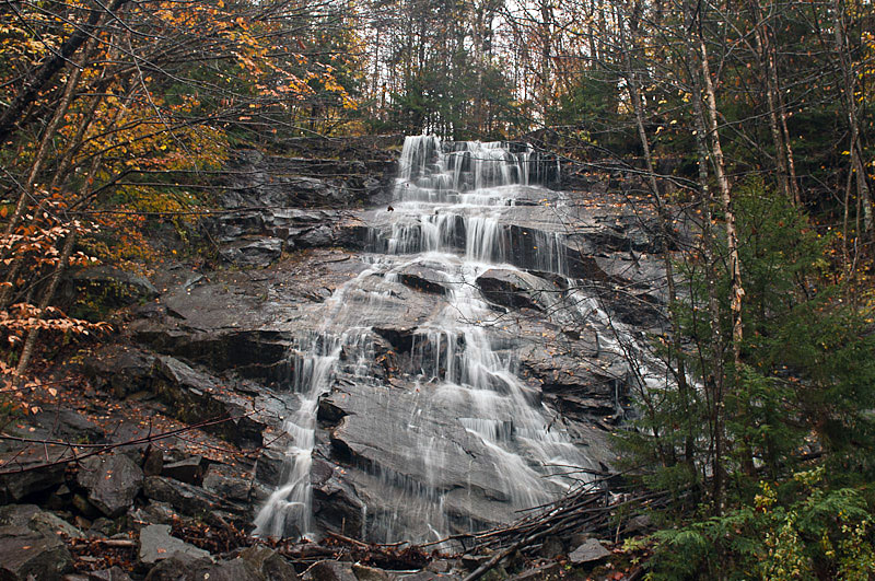
A Falls at the End of the Trail Along the River
Another View
A Wet Trip to the Adirondacks, October 6th & 7th, 2010, Day 1
Back to the Home Page
All photographs Copyright © 2010 Jon R. Vermilye
To see a larger image, click on the photo
Other Pages:
Animals & Insects
Birds
Flowers
Flowers, Page 2
Landscapes / Scenic
Lighthouses
New England & Nantucket
Oswego
Other
Images
State & National Parks
Theatrical Images
Waterfalls
Adirondacks Trip Fall, 2004
Adirondacks Trip, Fall, 2007
Rain has been predicted for at least the start of the week, but this is the time the Adirondacks are at peak color, as least according to The Foliage Network. I decided to wait until Tuesday, then until Wednesday, at which point, since I will be delivering Meals on Wheels Friday & teaching a photography class on Saturday, I either had to go or skip the trip. Next week I'm shooting rehearsals for SUNY Oswego's production of Dracula, after which I plan to make a trip south.
I decided to plan the trip by entering coordinates for some waterfalls in my GPS. It worked reasonably well - I picked out most of the falls I wanted to visit using Jon Binder's New York Waterfalls page and and found the coordinates by using the search box for each waterfall on The Adirondack Experience page.
Wednesday started out with sunshine, of course, since I was driving east! I decided to hit one waterfall that was outside the park - Pixley Falls State Park just west of Boonville, NY. By the time I got there, the rain had started to fall. The main falls was not all that interesting, but a couple of the side streams, cascades & small waterfalls were worth the trip. I suspect that the main falls is more interesting with lower water levels. The combination of last weeks heavy rain & the last couple of days of heavy rain has swollen most of the streams & rivers in the area. I did use my camera GPS when shooting, so the large version of each image should have the locations of the camera in the EXIF file. For what ever reason, the camera GPS took a long time to find the satellites I gave up waiting for it when taking the Pixley Falls images, but the information is there for the rest of them. If you need to know the location, it is at LAT: 43.4062946192
LONG: -75.3425216675.
|
|
|
The Park Entrance |
Pixley Falls |
Another Brook in the Park |
|
|
|
A Falls at the End of the Trail Along the River |
Another View |
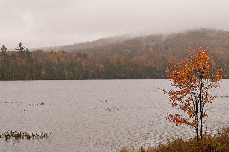
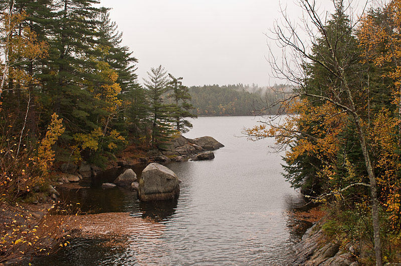
After Pixley Falls it was off to Boonville & into the Adirondack Park on Rt 28. My first stop for a photo was going to be Limekiln Falls, however I never found it. After I took Limekiln Road I found a park, but I even asked a couple of conservation workers in cutting trees the park, and they never heard of it. So, I took a photo of the lake:
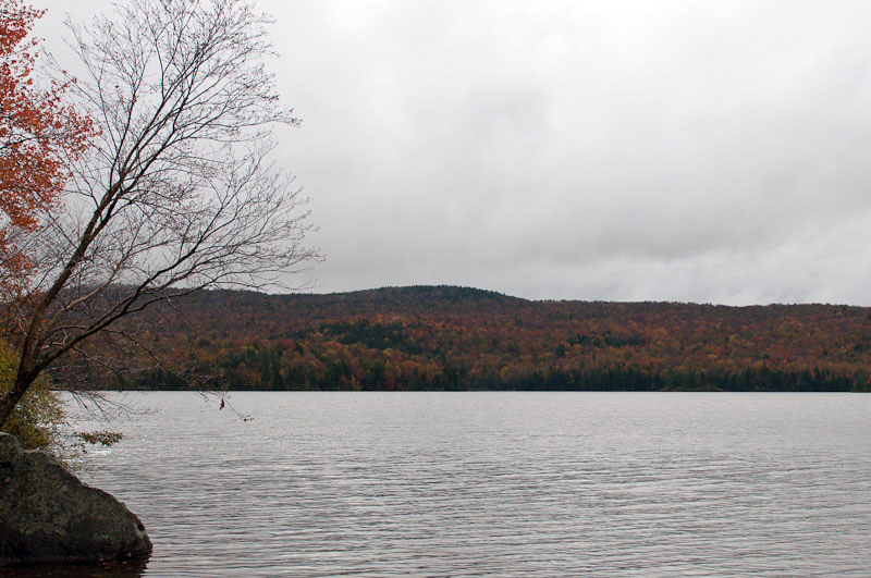
Not all that interesting, but after driving all the way out there I had to shoot something!
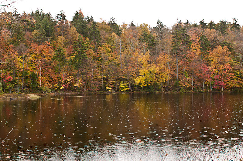
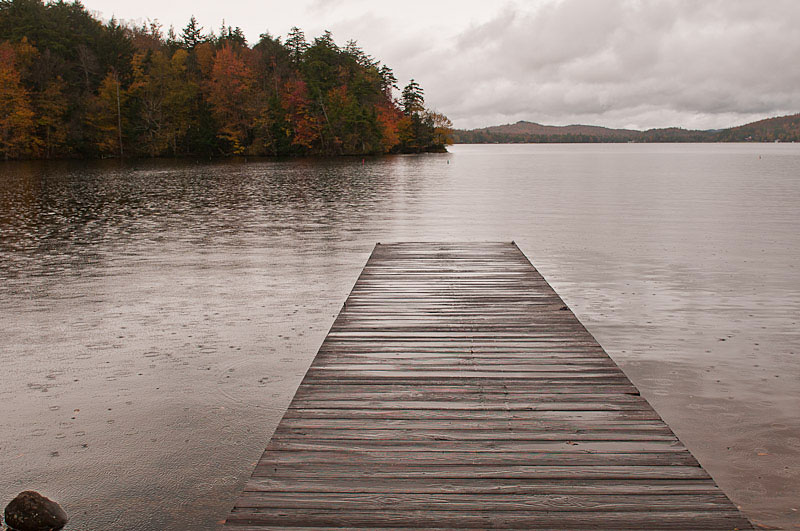
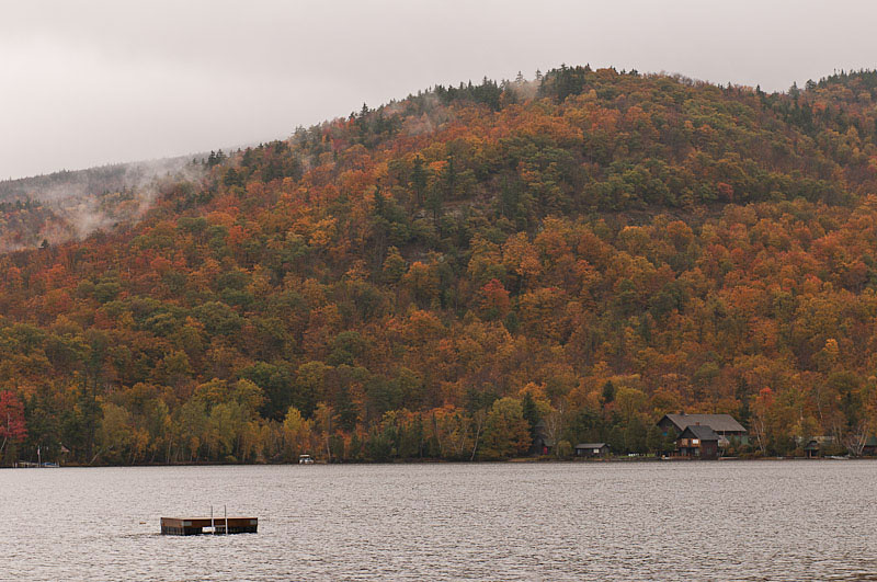
Next was a stop at 7th Lake along Route 28. At least there was a little more color on the other side of the lake. By the way, those are raindrops on the surface of the lake. There was a dock that added some interest:
 |
 |
Continuing along Route 28 I viewed miles of beautiful color on the trees. Of course there was lots of distortion caused by all the water dripping off the windshield, but pretty just the same.
I stopped for my first waterfall at Death Falls, aka Secret Falls. A short walk off Route 28 near the South Bay of Raquette Lake.
 |
 |
After walking back to the car (in the rain) I stopped at Blue Mountain Lake and Lake Durant for a couple photos of mist on the fall foliage.
 |
 |
Blue Mountain Lake |
Lake Durant |
Although I found Squaw Brook Falls under a bridge on Route 30, access to it was on posted private property and there wasn't a good way to shoot it. Rather than waste the stop, I took a photo of the inlet from Indian Lake where the stream from the falls enters:
After that it was a short drive down Rt 30 to Sepculator where I planned to stop for the night. Although it was still early (around 1:00) the town is fairly small with little in the way of motel rooms so I decided to get a room & then hit the near by waterfalls. It was good that I did - I got the last room at the Cedarhurst Motor Lodge. They must not have reached the off-season rates - $65.00 per night. Still, it is the "only motel in Speculator that has bathtubs in every room", and the room was very nice, complete with cable TV, free WiFi, a fridge & microwave and comfortable beds. The rain made a gentle patter on the roof...
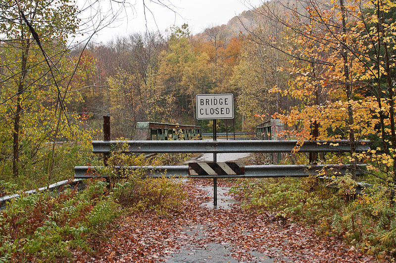
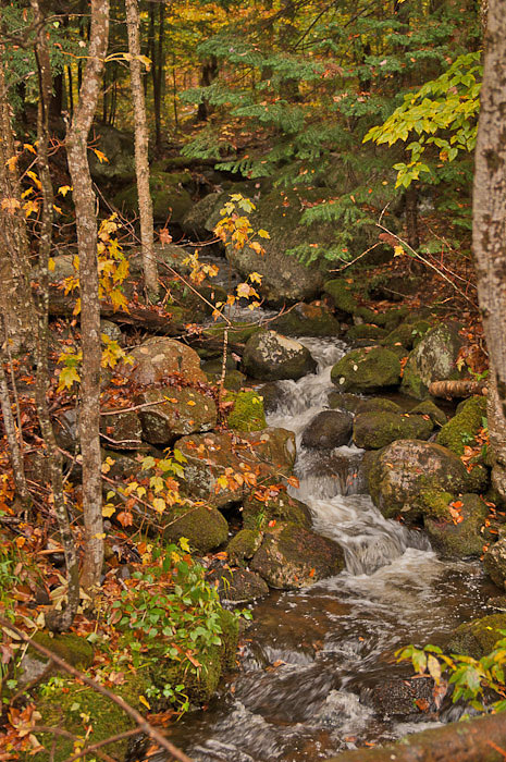
After getting my key I went looking for old Rt8/Rt30. The entrance described on the waterfall page is closed - the bridge over the river is shot. I back tracked & found the other end of the road closer to Speculator. The river that includes Austin Falls and Christene Falls is part of the Sacandaga river system. It goes from gentle lake like sections to extremely powerful rapids. I took a photo of a small stream feeding the river along side Old Rt 8 and will go back tomorrow to shoot the waterfalls. It is raining so hard I can't keep the lens clean enough to take pictures!
 |
 |
 |
Old Route 8 Bridge |
Old Route 8 / 30 |
Stream Along Old Rt 8 |
This page is maintained by: vermilye@oswego.edu
Last Update:
March 21, 2012